

Tokyo 1900-1950
-

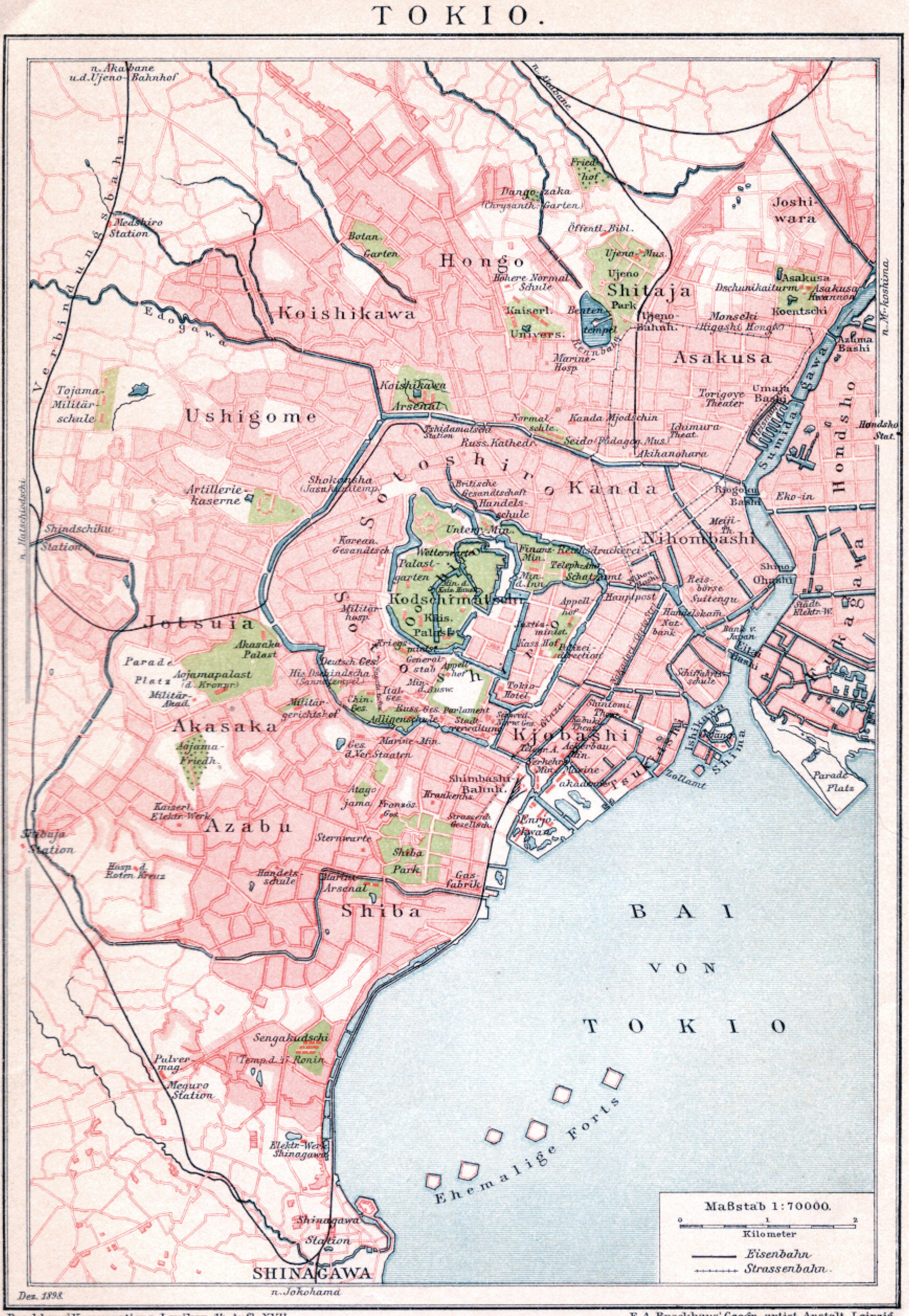
- Tokyo, 1898.
-

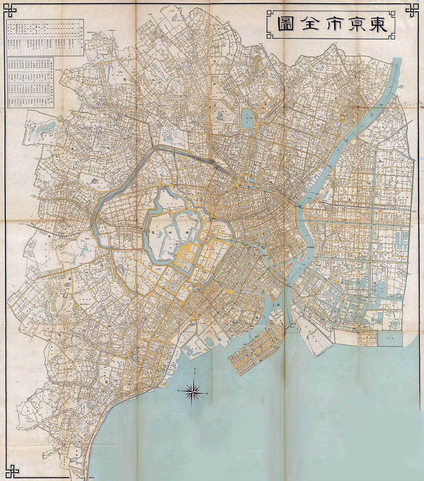
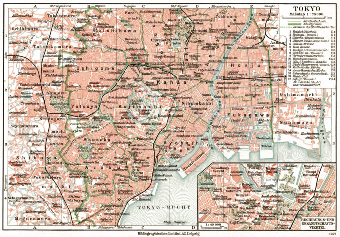
- Tokyo, 1905.
-
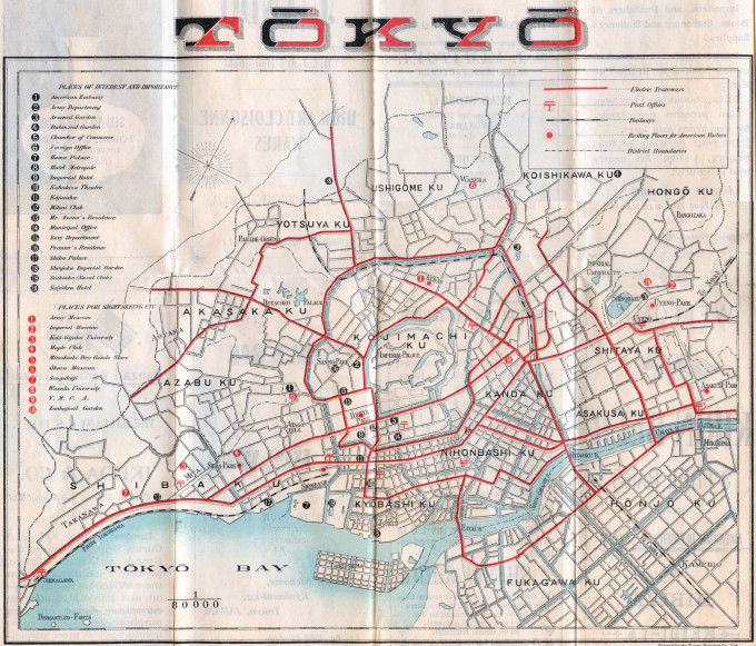
- Tokyo, 1908.
-
- Tokyo, 1915.

-
- Tokyo, 1918.
-
- Tokyo, 1920.

-
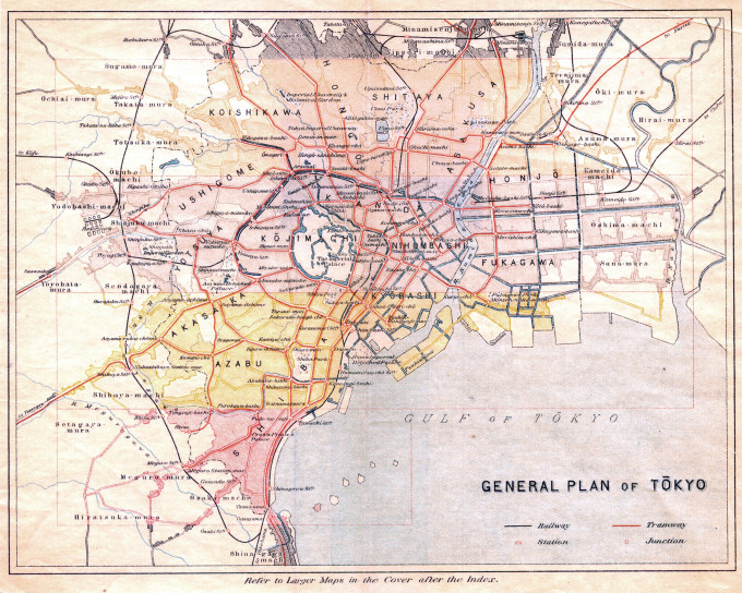
- Tokyo, 1930.

-
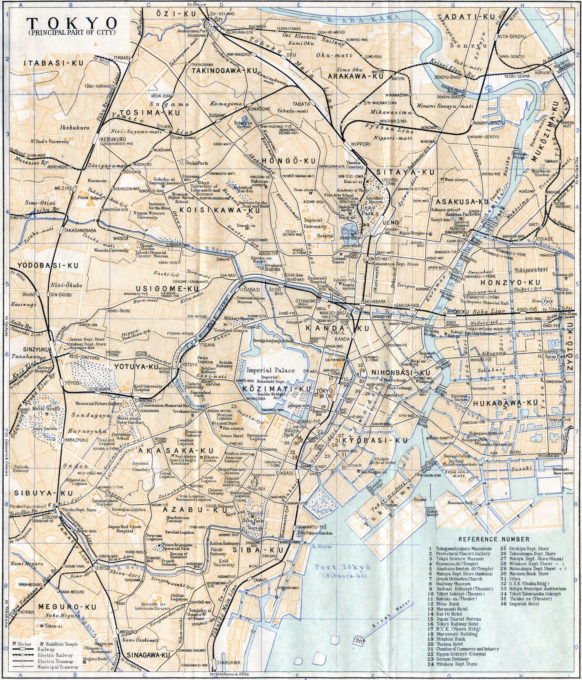
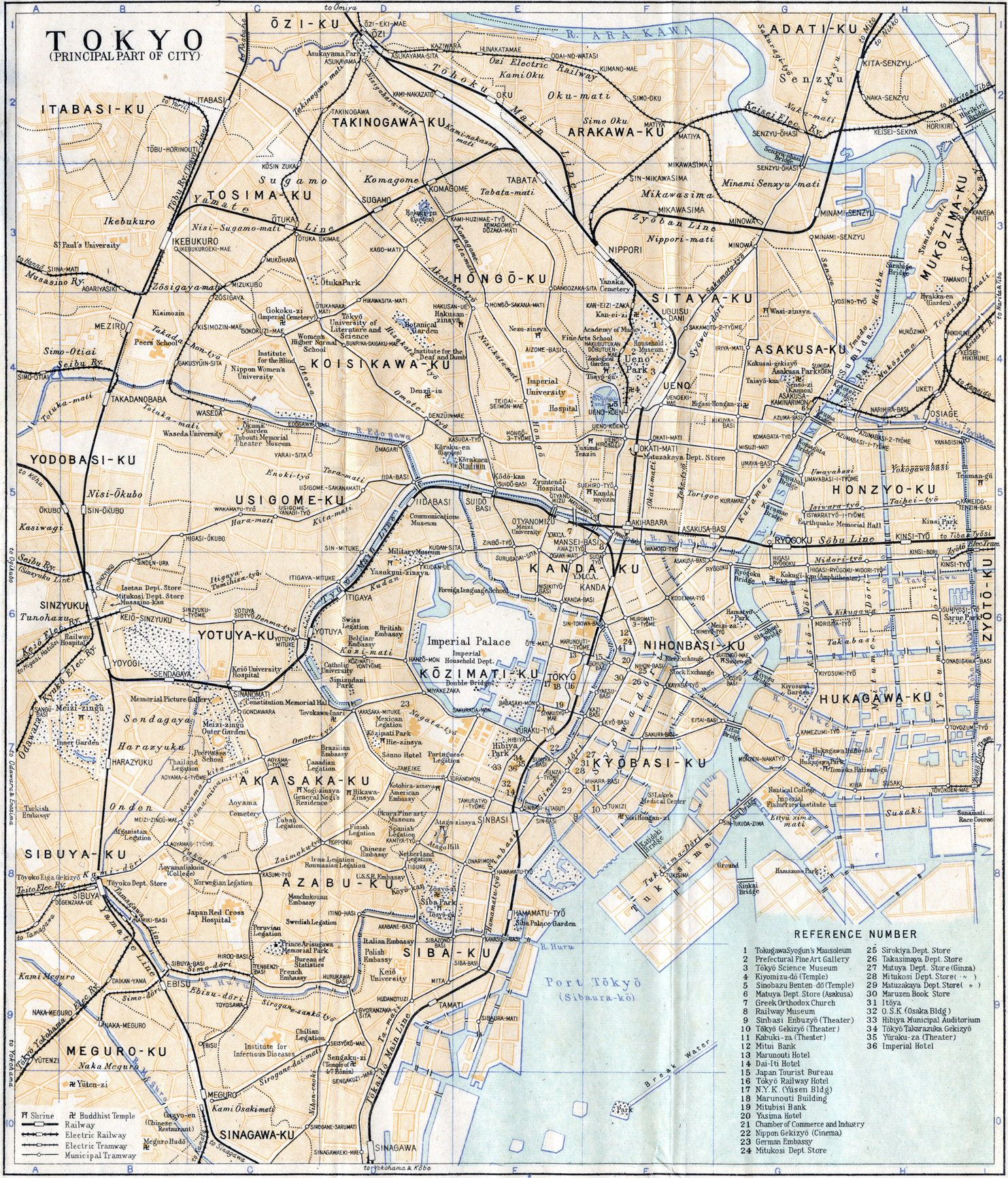
- Tokyo, 1940.
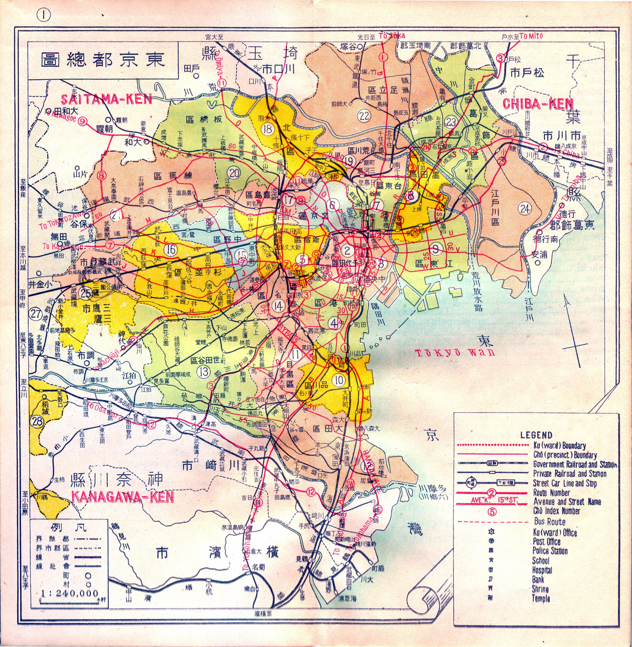
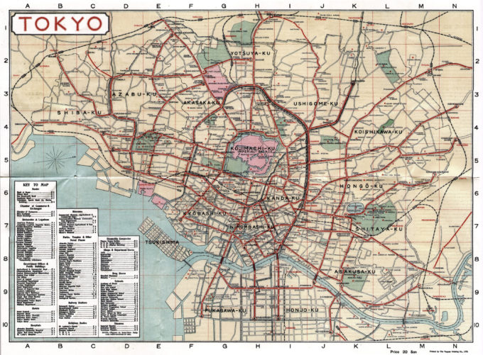
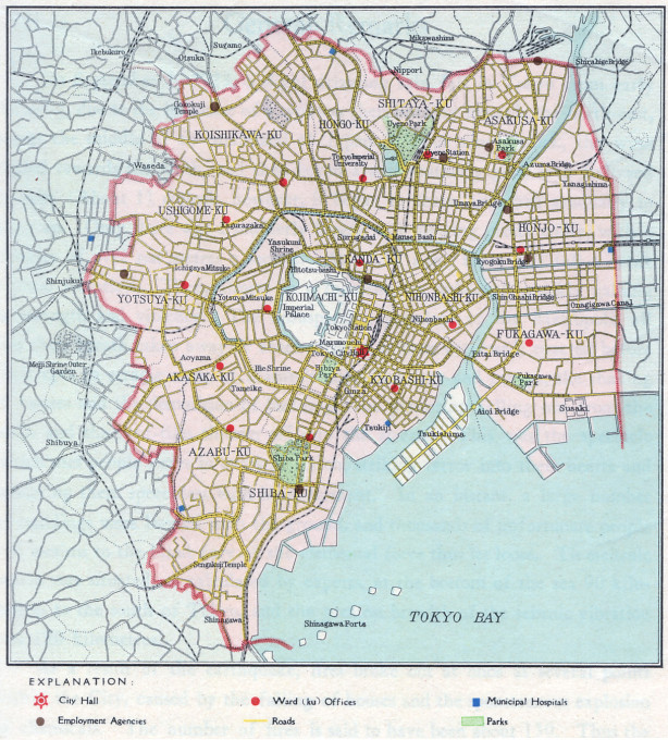
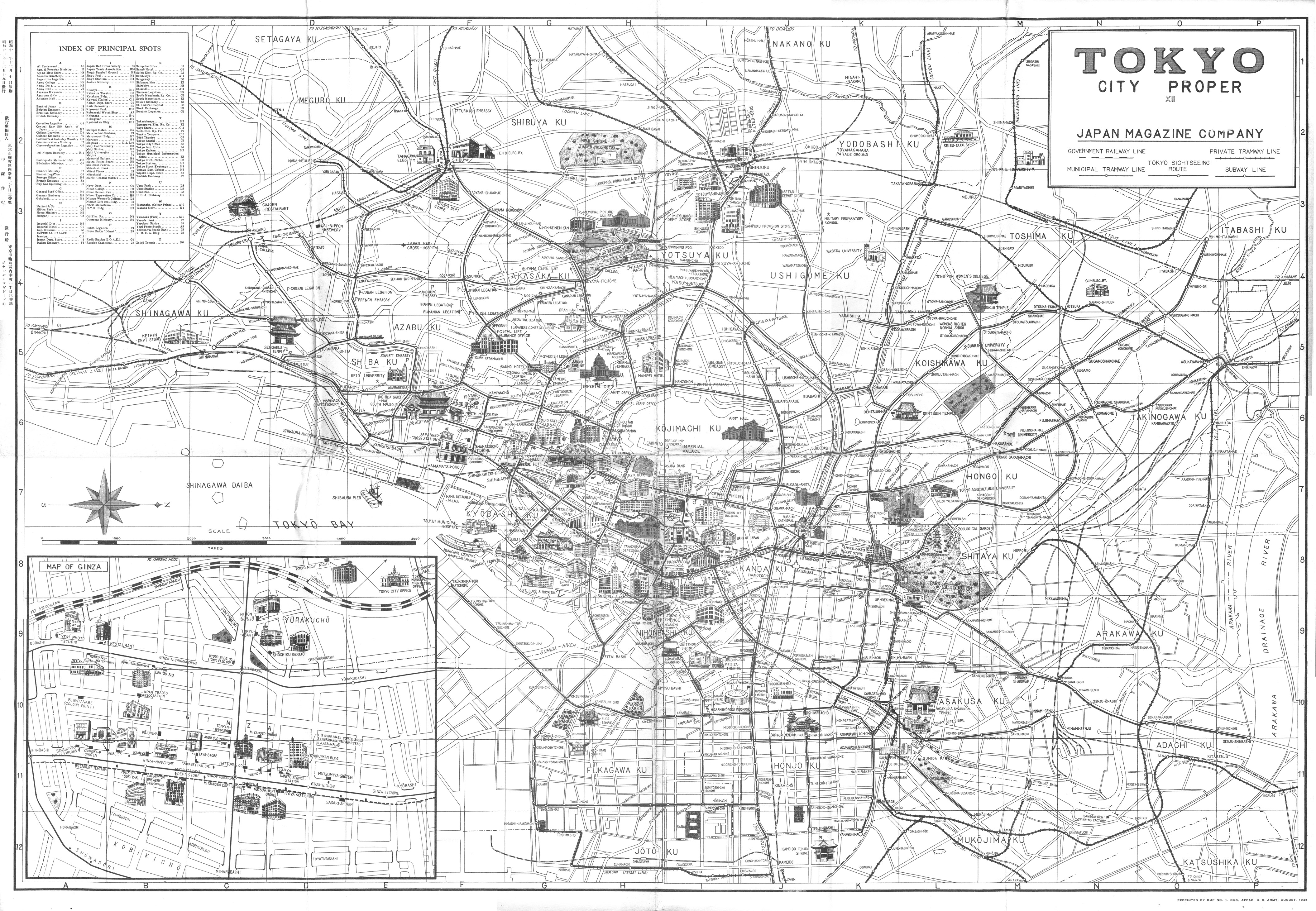
Tokyo city wards, c. 1950.
Japanese Empire (East Asia), 1940

Tourist map of the Japanese Empire, c. 1940, depicting the Home Islands (right), Manchukuo, Korea, East China, and Formosa before the start of the Pacific War.
Tokyo in distress
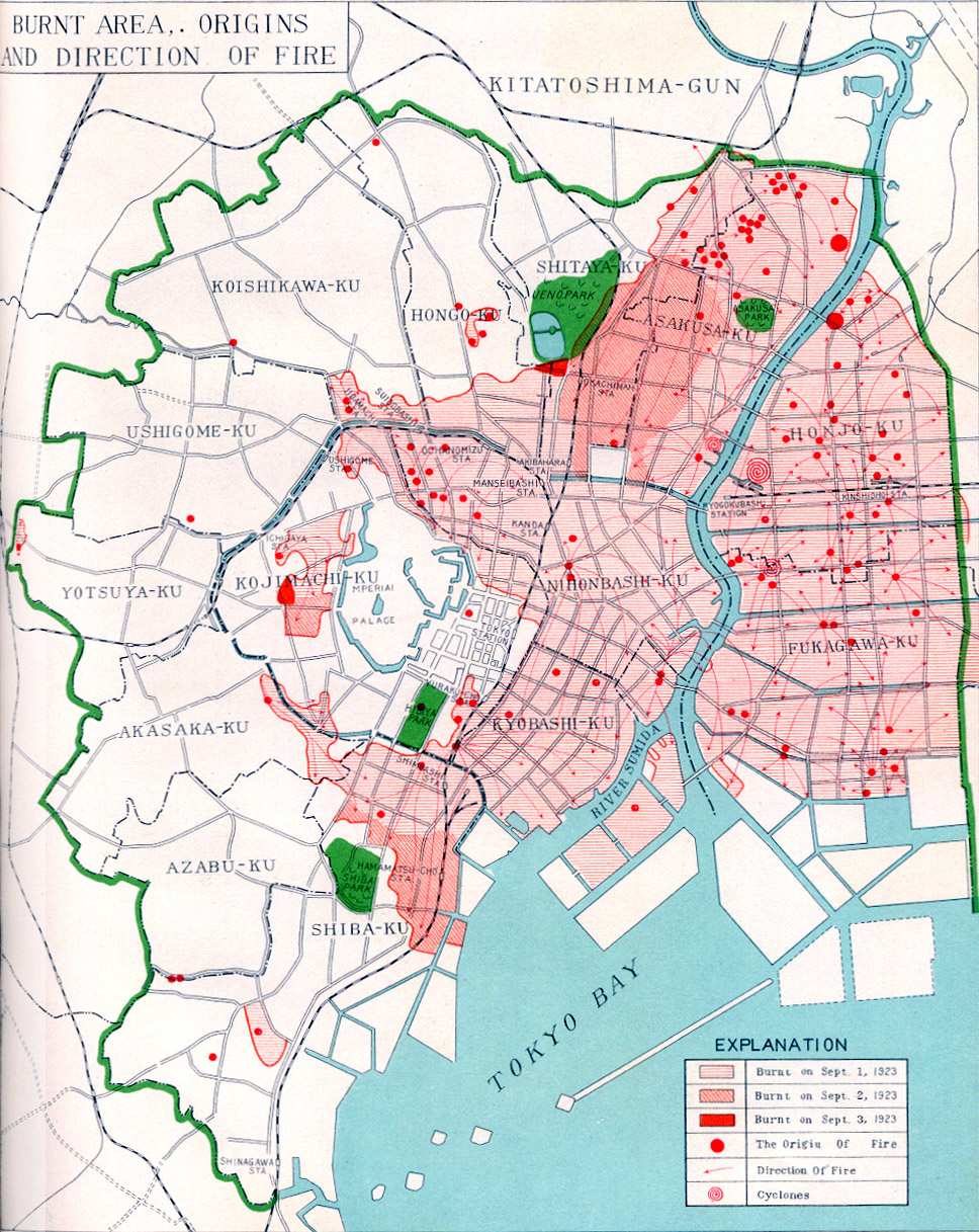
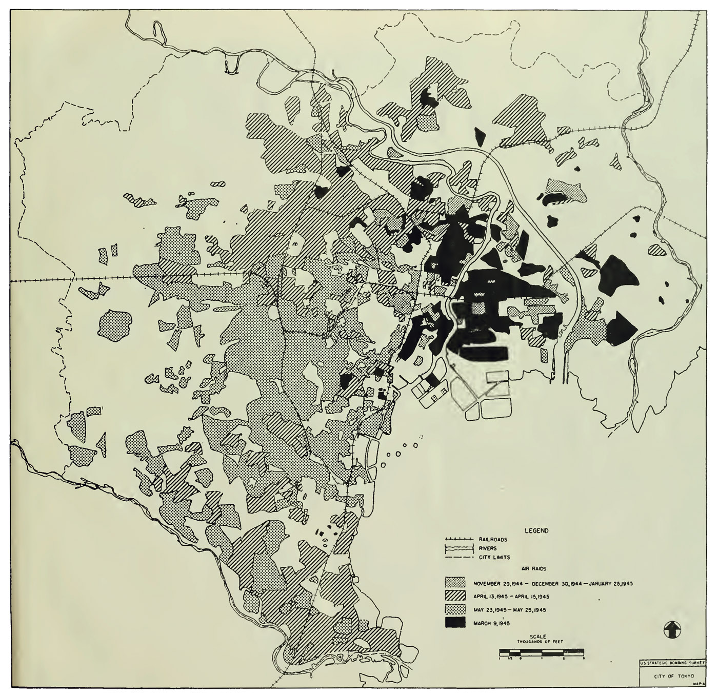
Two major events within 25 years of each other forever altered Tokyo – the 1923 Great Kanto earthquake, and the 1945 firebombings during the Pacific War. The earthquake, which killed 142,000 people and created firestorms that raged for three days, erased much of the modern urban landscape built during the Meiji era. The wartime firebombings flattened Tokyo’s shitamachi, the oldest residential areas of the capital and, with those, the remaining vestiges of feudal-era Edo.
-
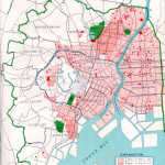
- Tokyo, Great Kanto earthquake damage, 1923, illustrating origins and extent of fire damage. (Source: Tokyo Reconstruction Work, Tokyo Municipal Office, 1930.
-
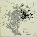
- US Strategic Bombing Survey map, 1944-1945, illustrating the sections of Tokyo that were firebombed.
Occupied Tokyo, 1945
A pre-war tourist map repurposed for the Occupation. Dated 1945, when much of the city was still a burned-out hulk.
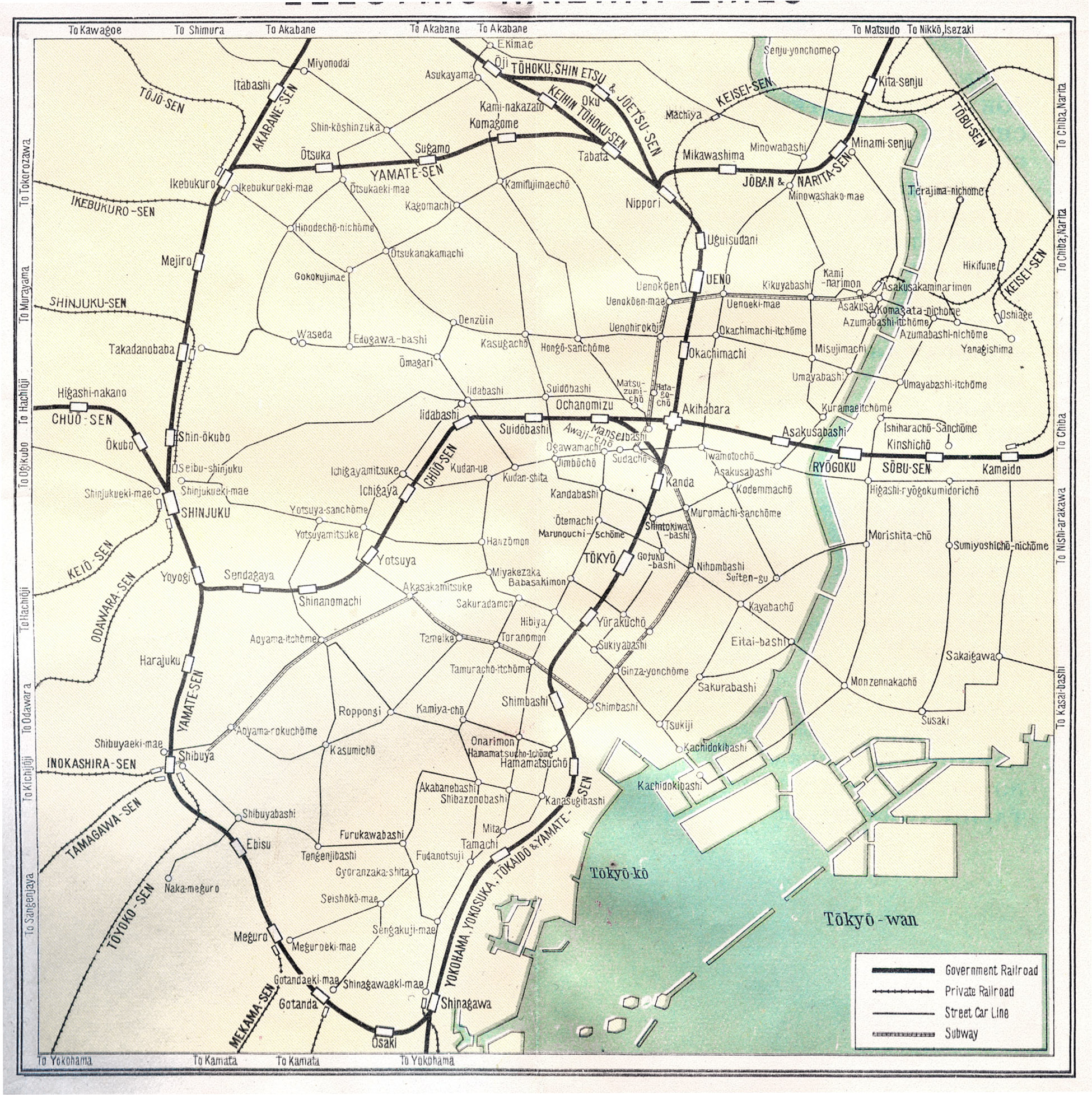
Tokyo transportation
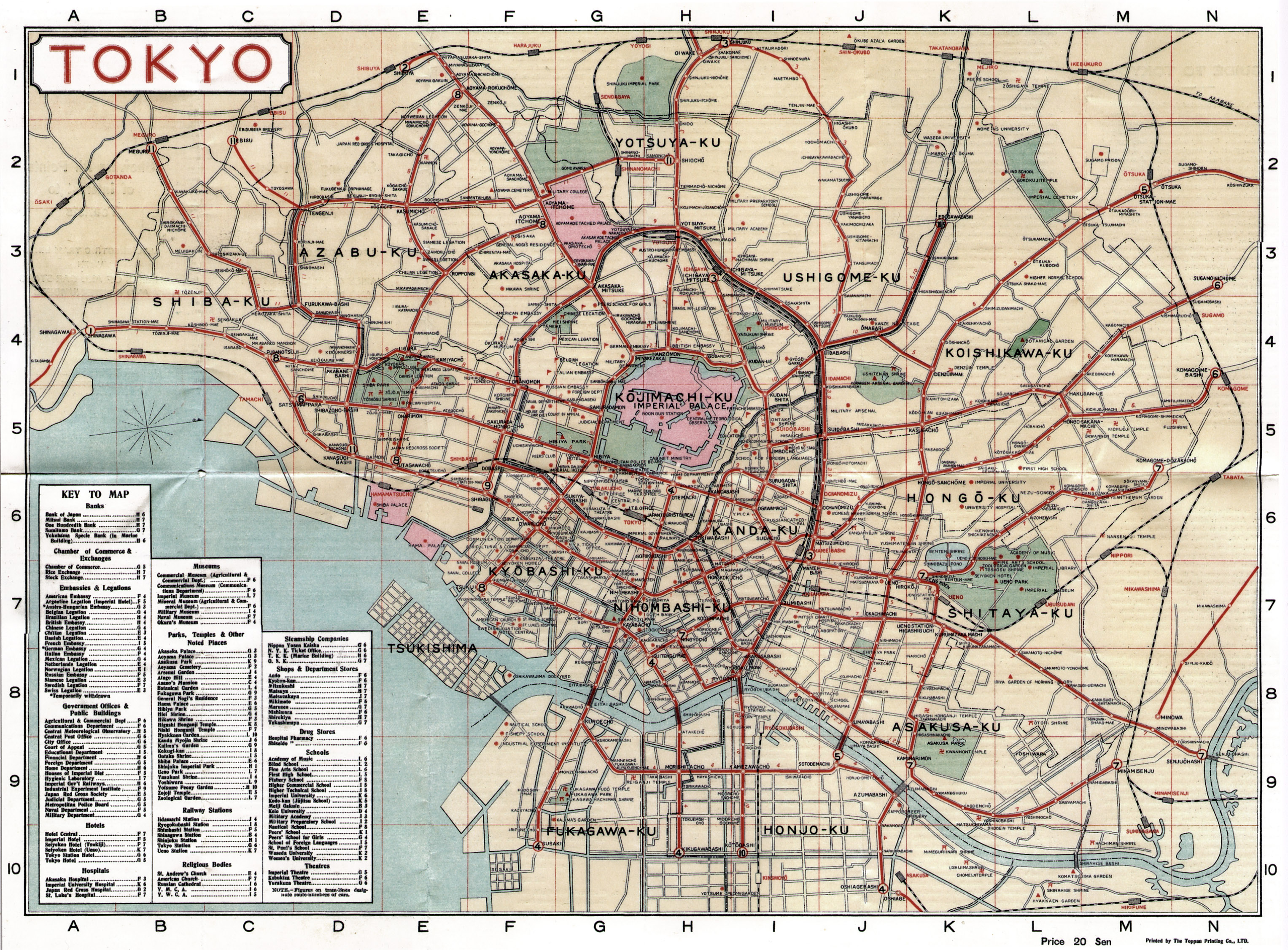
Beginning with the introduction of a 29-km stretch of railroad in 1872 linkng Tokyo, the capital, with the port city of Yokohama, Japan was able to rapidly embark on and expand its modernization goals from urban cores into rural hinterlands. By 1903, over 5000-miles of national and private railway had been laid throughout the Home Islands. Add to that the many hundreds of miles of streetcar track crisscrossing Tokyo’s canals and modern boulevards, from industrial low-city shitamachi to affluent high-city yamanote – plus, the rapid expansion of city bus services in the aftermath of the 1923 earthquake – and Tokyo was able to transport its growing population (under 1-million persons in 1870; more than 6 million persons in 1940) to work, rest and recreation.
-

- Tokyo rail systems (c. 1950). Dark solid lines are railways; light solid lines are streetcar routes.
-
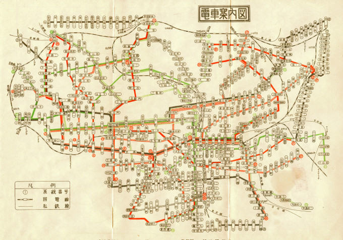
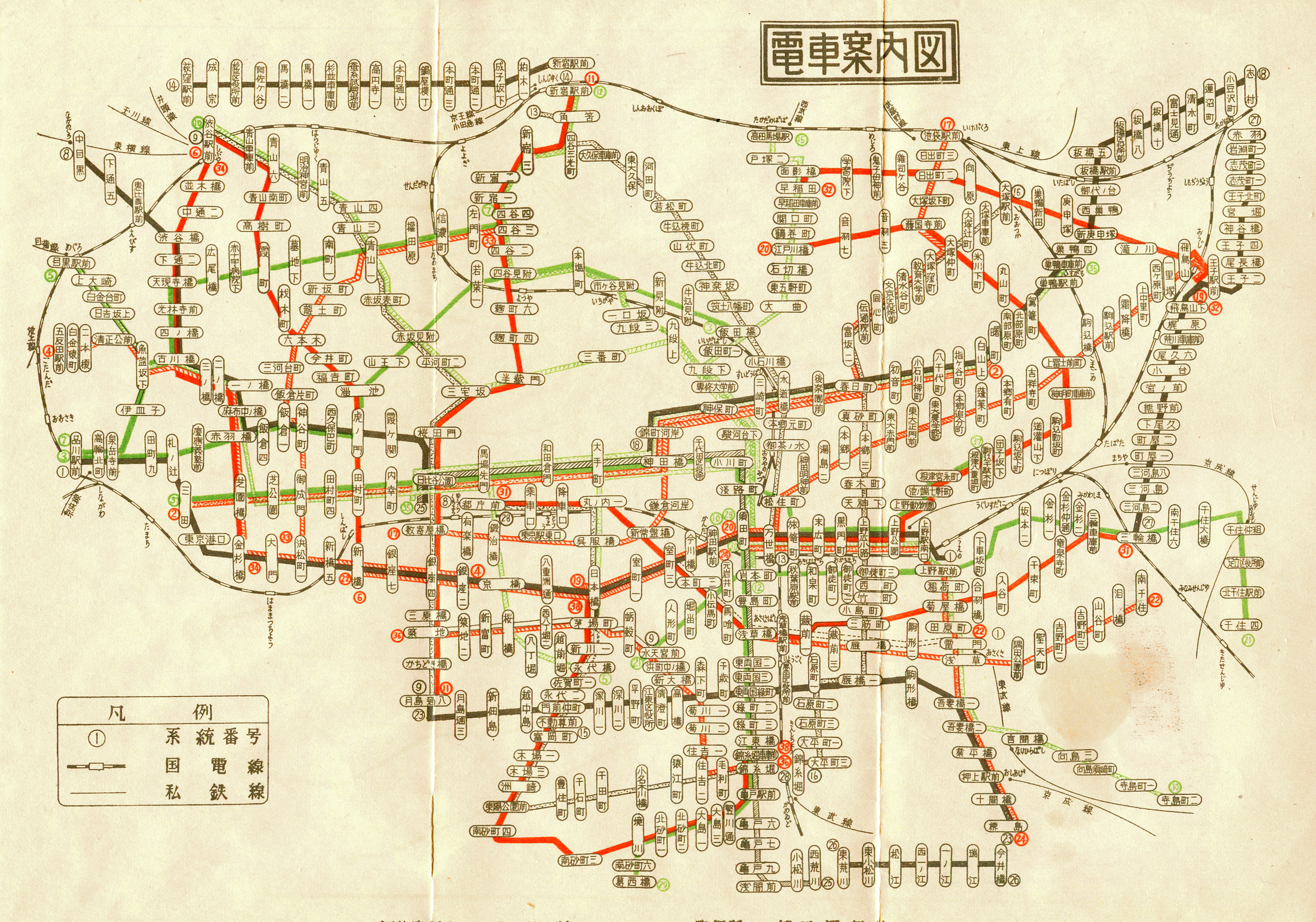
- Tokyo streetcar map (c. 1950).
-
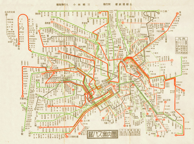
- Tokyo bus map (c. 1950).

-

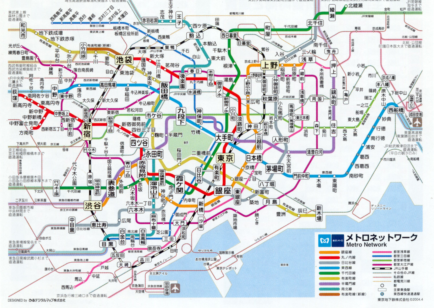
- Tokyo metro network (c. 2000).
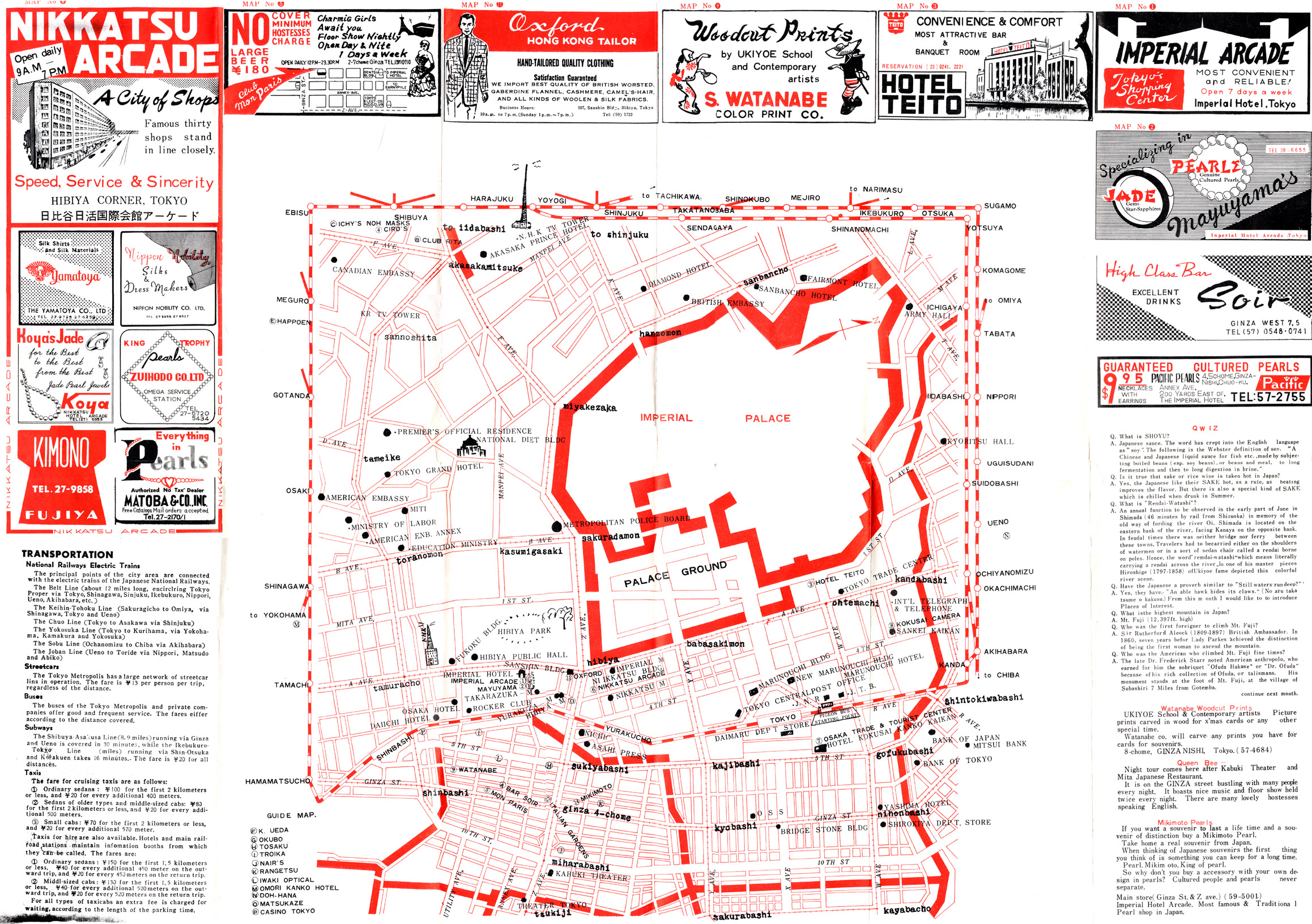
Tokyo tourist map, c. 1957
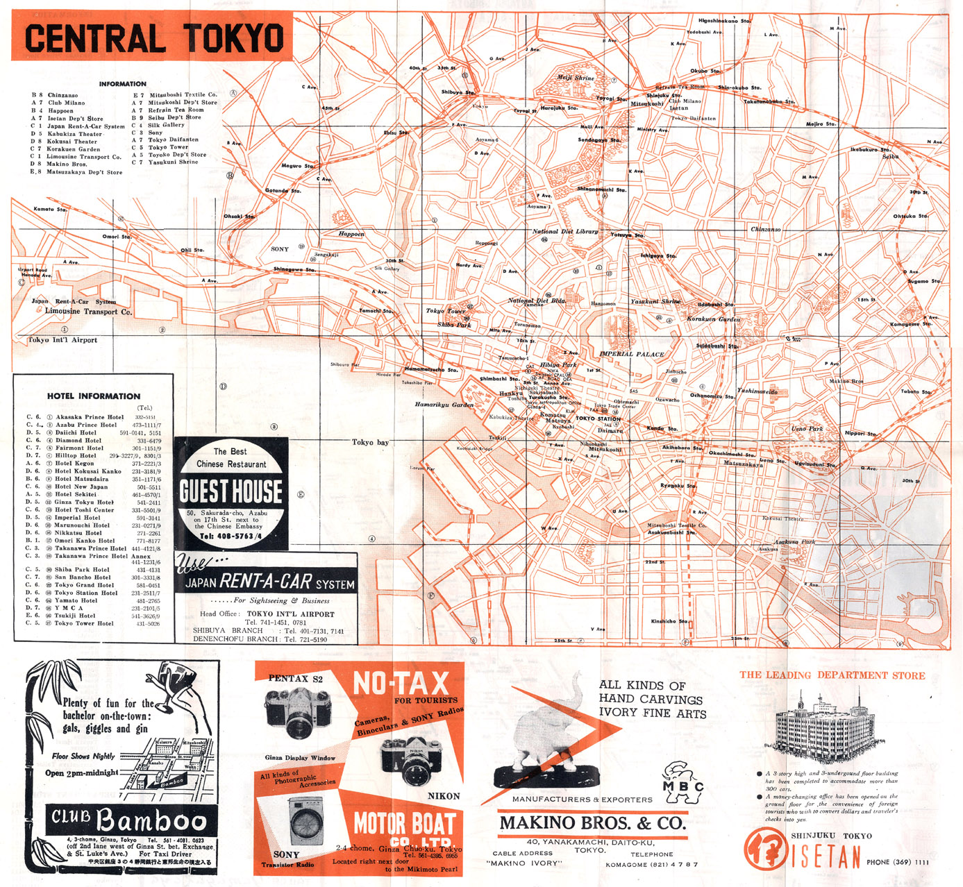
Tokyo tourist map, c. 1965
Pingback: Tokyo streetcar maps | the tokyo files: maps マッピング東京
Pingback: Transit Maps
Pingback: Map Of Tokyo – George Duarte