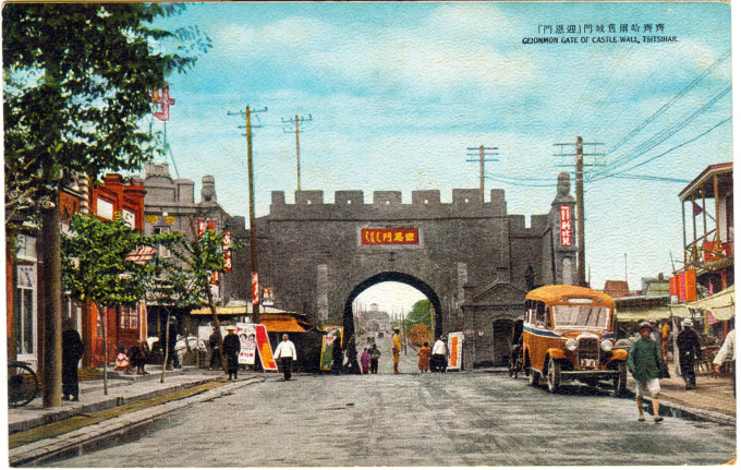
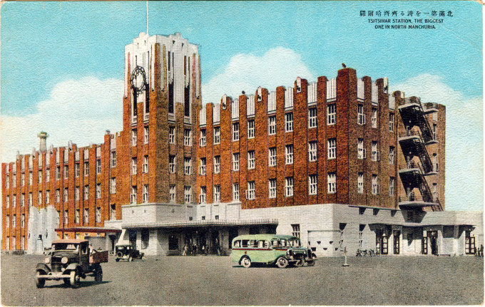
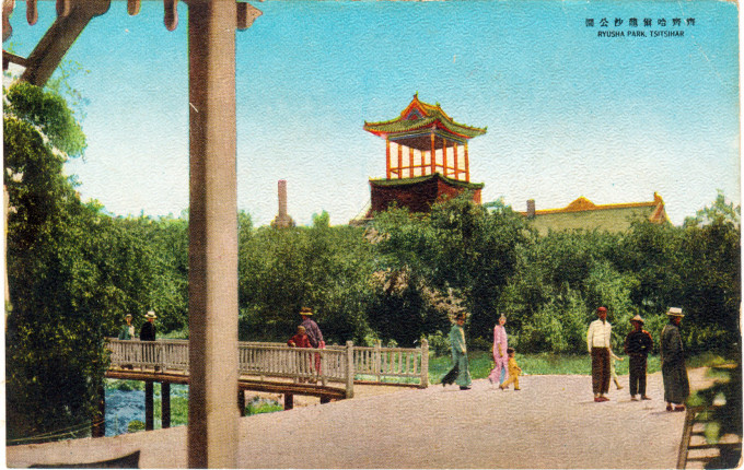
“Tsitsihar, the former capital of Heilung-chiang Province and former military citadel of North Manchuria, is really off the beaten-track of the tourist and sight-seer, because it lies 25 kilometers away from the North Manchuria Railway main line and because until recently only a narrow-gauge indifferent railway was available to the city.
“Things have now changed, thanks to the rapid and efficient railway-construction of the young State, which has transformed Tsitsihar into a bustling railway centre, with railway running East, West, North and South.
“Thus it is that yearly, Tsitsihar will become more and more important, and will attract the tourist, because of the practically unknown country these new railways have opened up.
“… Because the soil of the Tsitsihar area is, on the whole, sandy it is not suitable for the cultivation of the usual crops produced in abundance in other parts of the country, but this shortcoming is offset by the fact that this sandy soil is best fit for the growing of cucumbers and watermelons. This accounts for the high reputation which Tsitsihar watermelons command throughout Manchuria.
“Tsitsihar is also known for the production of a variety of river fish. The Nonni River, flowing by the city, is teeming with carp, gibel, catfish, white-fish, terrapine and other edible fish. Agate is abundantly produced along the Nonni river. This stone is made chiefly into cuff-buttons and other ornamental articles for shipment to other parts of the country.”
– “Tourist Attractions in Manchuria”, The Manchurian Month, May 1, 1936
“Qiqihar [Tsitsihar] is one of the oldest cities in the northeast of China. The region was originally settled by nomadic Daur and Tungus herdsmen. (The city’s oldest mosque, the Bukui Mosque, actually predates the foundation of the city itself by seven years.) As the Czarist Russian eastward advance to the Pacific coast, Qiqihar became a major garrison center in 1674. In 1691, a stronghold was constructed in Qiqihar because of the Qing government’s campaigns against the Mongols. Around 1700 it was a center for Russo-Chinese trade.
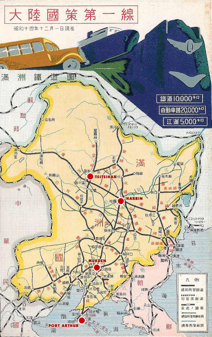
Manchukuo (Manchuria), c. 1940, and the major railways and roads connecting its four largest population centers – Port Arthur, Mukden (the largest), Harbin, and Tsitsihar – and its capital city, Hsingching [‘New Capital’, between Harbin & Mukden; now, Changchun] to the various areas of development in the colony.
“In 1903, the completion of the Chinese Eastern Railway made Qiqihar a center for communications between China and Russia. A network of lines radiating from Qiqihar was extended into the northwestern part of Heilongjiang Province including Jiagedaqi and Manzhouli in the late 1920s.
“After the Japanese began their occupation of Tsitsihar on November 19, 1931, Qiqihar was established as an administrative centre of the puppet Manchukuo government under pro-Japanese General Chang Chin-hui. Qiqihar was also established as the capital of Longjiang province, going by the name ‘Tsitsihar’. Tsitsihar became a major military base for the Japanese controlling northeastern China and its economic importance also grew rapidly. During the occupation, the Imperial Japanese Army established Unit 516 in Qiqihar for research into chemical warfare. (A major mustard gas tank left over from the Second Sino-Japanese War and buried underground was accidentally ruptured in August 2003, causing 43 injuries and one death.)”
– Wikipedia
“After Manchukuo was established, the Japanese state made the country’s more than forty prefectures compete with one another in a race to colonize Manchuria. The prefectures altogether sent a total of 322,000 farmers to Manchuria, but the winner, and therefore the most ‘patriotic’, was Nagano Prefecture. Nagano sent 33,741 colonists to Manchuria, about one-fourth of whom came from the Ina Valley.
“… The emigrants brought to the vast terrain of Manchuria the names of their ‘mother villages’ (bo-son) and established ‘branch villages’ (bun-son) of the same names. These names include Kawaji, Yasuoka, Chiyo, Kami-hisakata, Inatomi, Kono, Shimoina, Mibu, Fukihara, Inan, Minami-shinano, Achi, and Matsushima.”
– Memory Maps: The State and Manchuria in Postwar Japan, by Mariko Tamanoi, 2009


