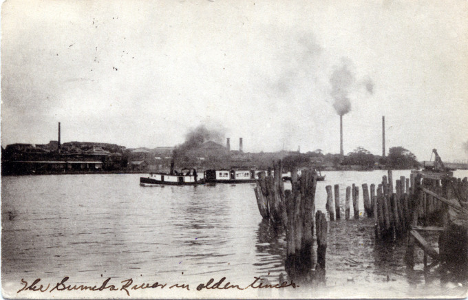
“Nagai Kafu wrote of the Hashiba ferry’s landing place, its rickety legs supporting a platform that jutted out into the river to a point beyond the mud flats.
“… From the Hashiba ferry, the waters of the Sumida flowed past a mixed scenery. The right bank was urban, lined with grey-tiled roofs of modest dwellings. The left bank, by contrast, was largely rural, with a scattering of temples, shrines and suburban retreats of retired poets, generals and industrialists. Later, in the early 1900s, this was to become an area of rapid industrialization.”
– Japanese Capitals in Historical Perspective: Place, Power and Memory in Kyoto, Edo and Tokyo, edited by Nicolas Fieve & Paul Waley, 2003

An excursion boat on the Sumida River at Hashiba, c. 1910. This stretch of the Sumida River, north of Mukojima and Asakusa, became the industrial artery of Tokyo by the late-Meiji era. Kilns and glassworks were among the first factories sited here, followed by tanners and textile mills.
The Sumida River has been Tokyo’s most important waterway since the founding days of Edo, encouraging industrial, commercial, recreational and leisure activities upon, around, and along its length. However, what is now known today as the Sumida-gawa [“corner field river”] was previously the path of the Arakawa (also known colloquially as “Okawa,” “Big River”); toward the end of the Meiji period, a great public works project was carried out to divert the main flow of the Arakawa east from the bend in the river at Suijin to prevent annual flooding that had historically occurred, hampering efforts to further develop the waterway.
The west bank of the river, north of Mukojima, was developed earlier than was the east bank, with Edo-era businesses involved in tile manufacturing, textile dyeing, lumber milling, and metal smelting and casting. Meiji-era modernization brought large-scale manufacturing and factories to the area, including glassworks. Seiko Co. manufactured its first clocks and watches in a large factory on the banks of the Sumida.

